Just-in-time spatial
Acquisition, storage, & lightweight presentation of dynamic data
John J Czaplewski | UW - Madison | @JJCzaplewski
Maria Hart | CFIRE | @freightplanner
Outline
- Scraping
- Presentation
- Separating geometry and attributes
What it is:
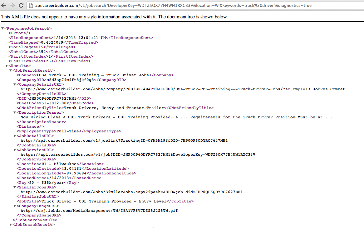
- Programmatic data acquisition
- Data transformation and extraction from known sources
- Accessing previously inaccessible data
Who (might) care:
- Researchers
- Journalists
- Hobbyists
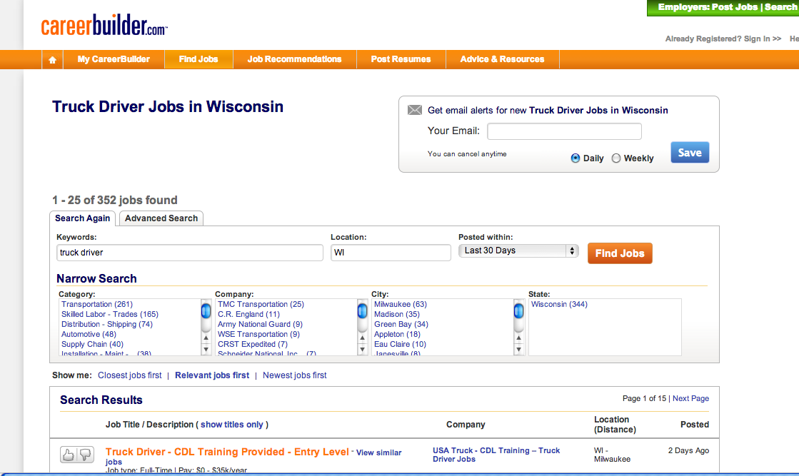
Why can't I just download a spreadsheet of the data?
- Data provider doesn't realize the value
- Publishing is an afterthought
- Competitive advantage
Picking the right source
- Keep it targeted
- What's it worth?
topojson
An extension of GeoJSON that encodes topology
Natural Earth 10m Sovereign Entities
- Shapefile: ~ 11mb
- GeoJSON: 24.7mb
- Topojson + CSV: 2mb
Know your limits (or proxies)
- Test locally
- Process locally
- Download slowly
Why all open-source?
- Tool options
- Control
- Share / Repeat
Example: City of Madison Data
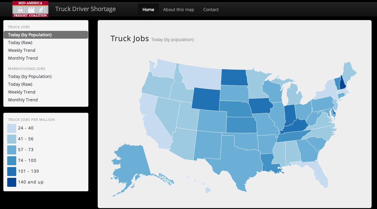
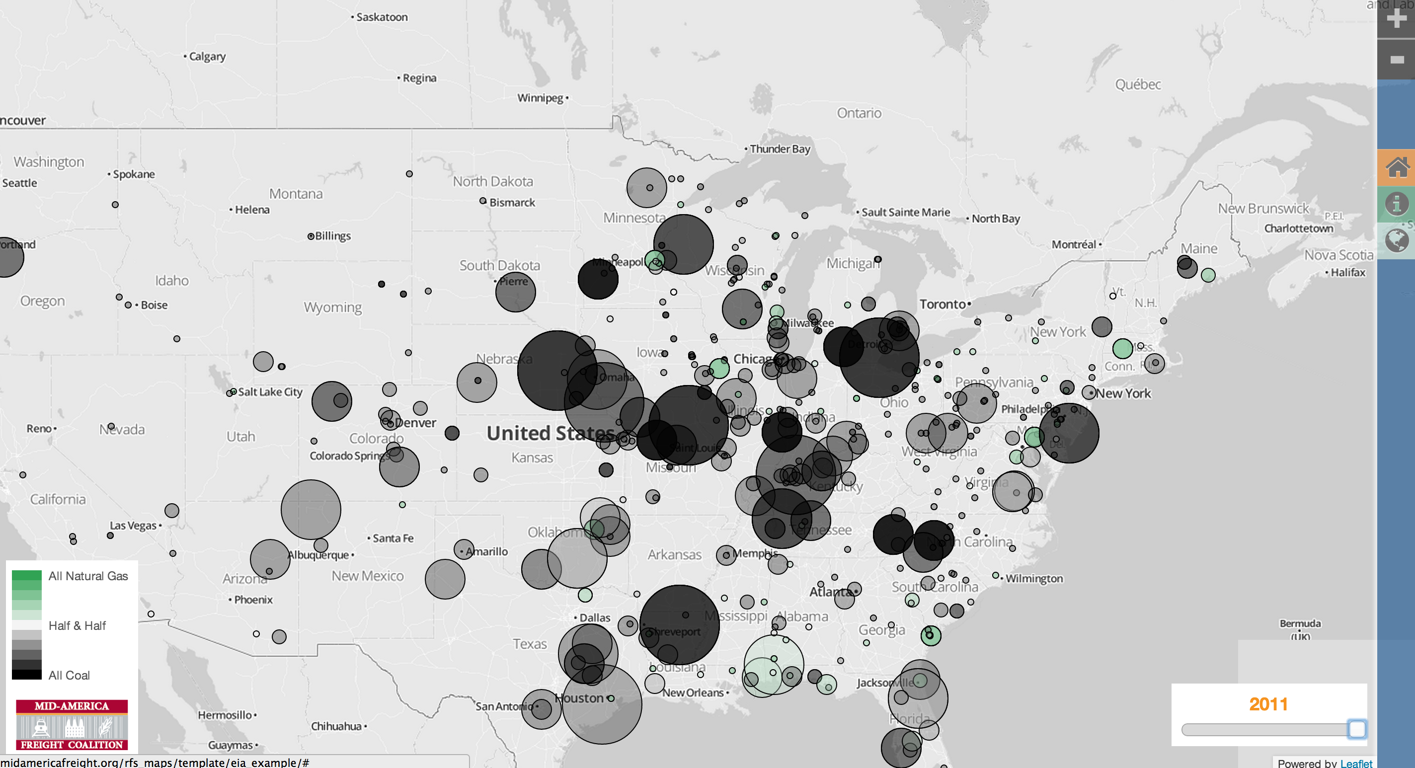
Truck Driver Shortage
http://midamericafreight.org/rfs_maps/drivershortage
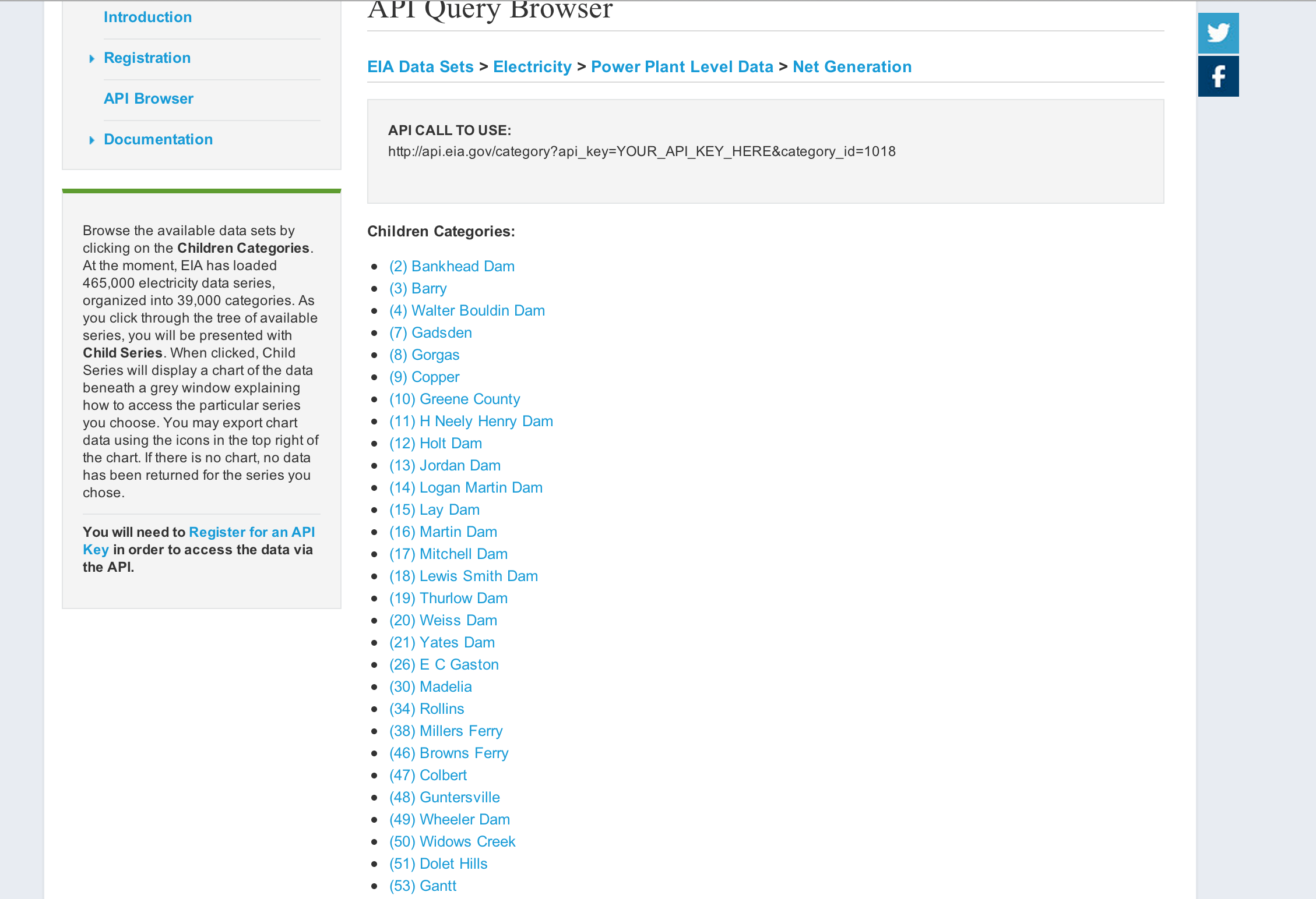
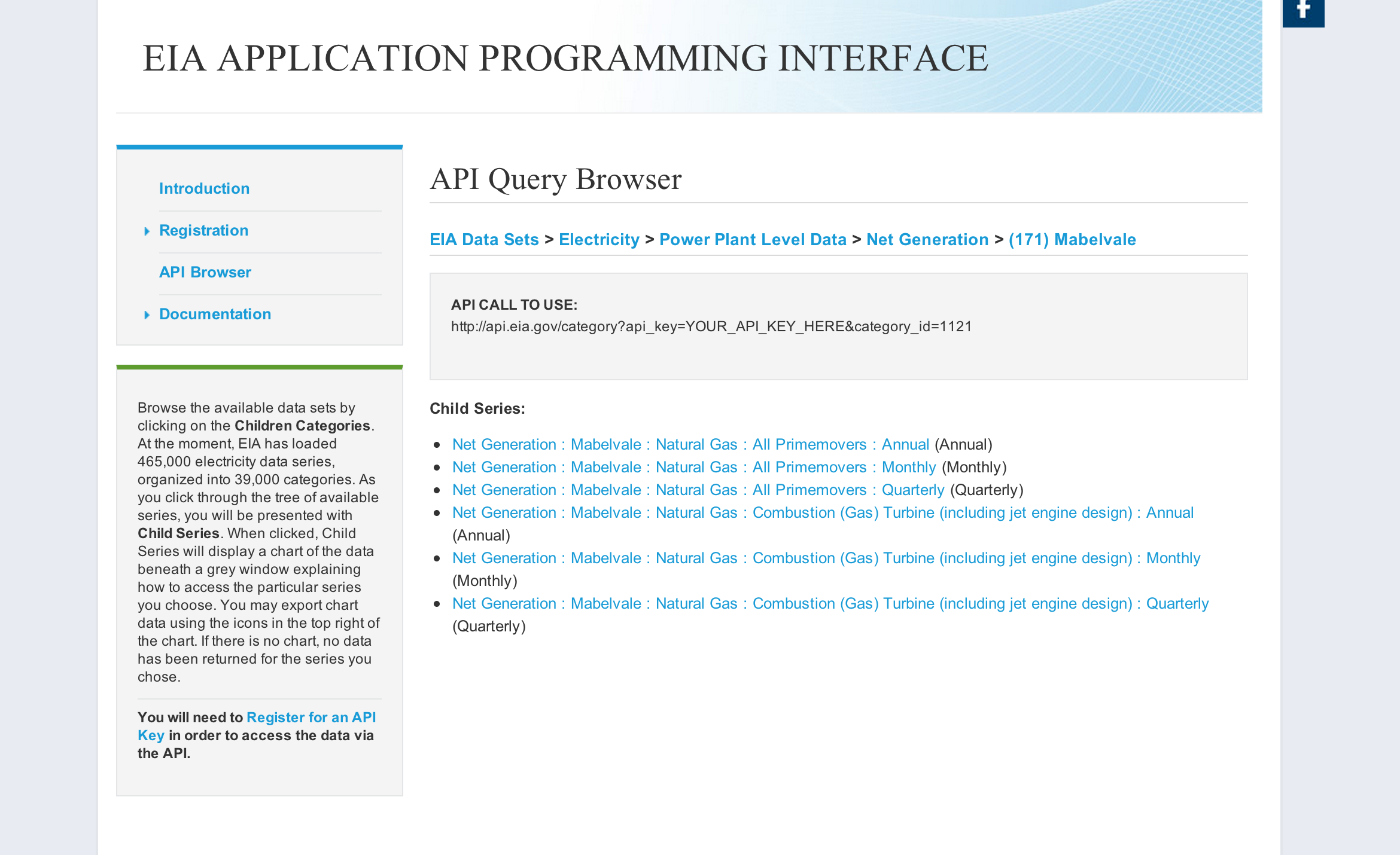
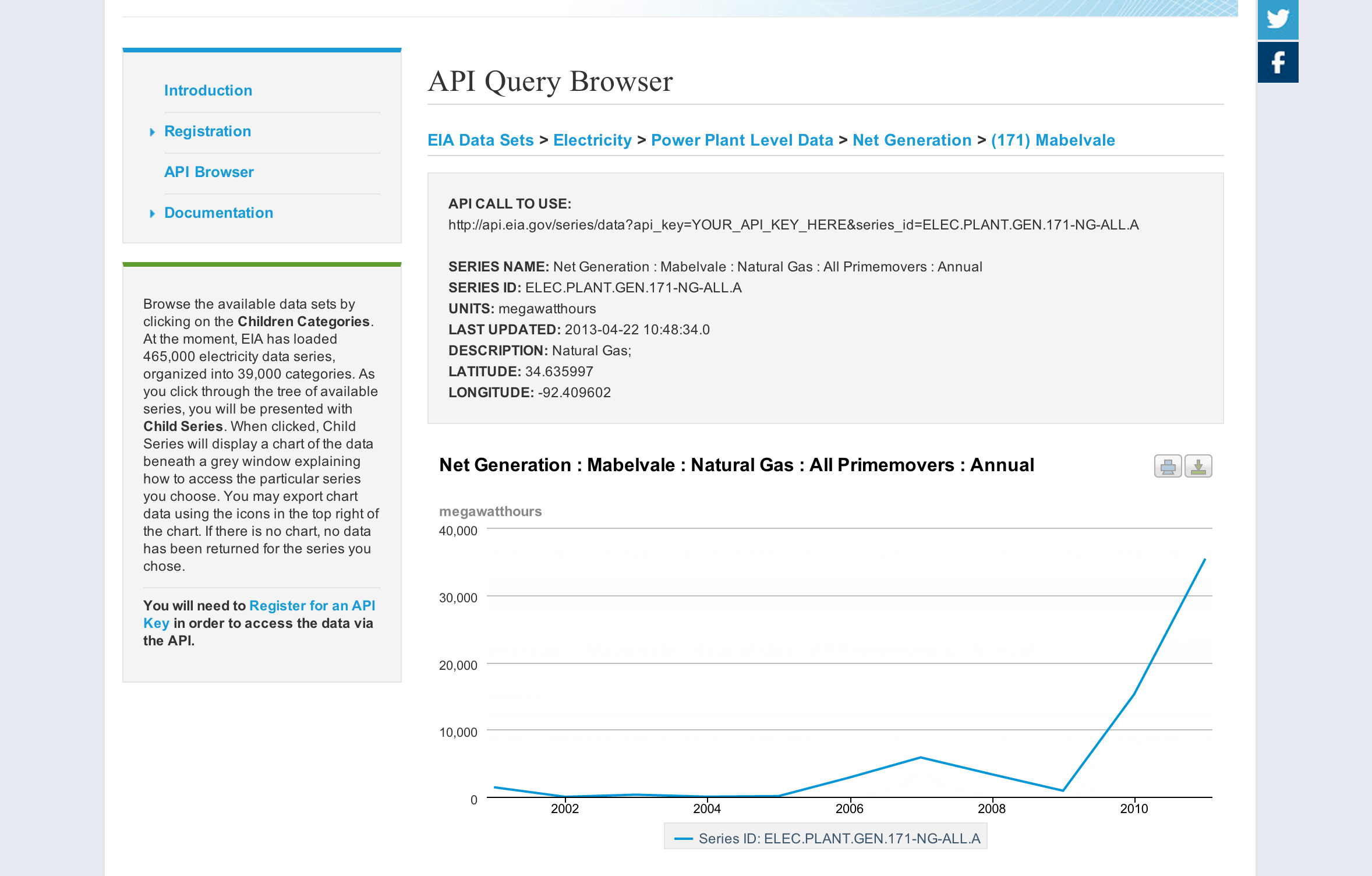
Energy Information Administration (EIA)
http://midamericafreight.org/rfs_maps/template/eia_example
Find the slides at http://johnjcz.com/presentations/foss4g2013
the code at https://github.com/jczaplew/foss4gna_examples
and me @JJCzaplewski
Questions?